
https://www.youtube.com/watch?v=kZ5XKH4od3E
It sheds light on the confusion and wild theories that were floating about in the days following the disappearance of the flight...


https://www.youtube.com/watch?v=kZ5XKH4od3E
It sheds light on the confusion and wild theories that were floating about in the days following the disappearance of the flight...
You will never know what you will be capable of until you try


That confusion and wild theories are still going on BTW.
'My idea of a good picture is one that's in focus and of a famous person doing something unfamous.' Andy Warhol

Does Malaysian Air fly into the US?


I believe that they may still be flying to LAX, but not for long. They announced a few months back that they were pulling out of North America entirely.
Ben Granucci, Wappingers Falls, NY
NYCAviation Senior Editor & Director
On Twitter @blgranucci
More photos on Flickr
[email protected]
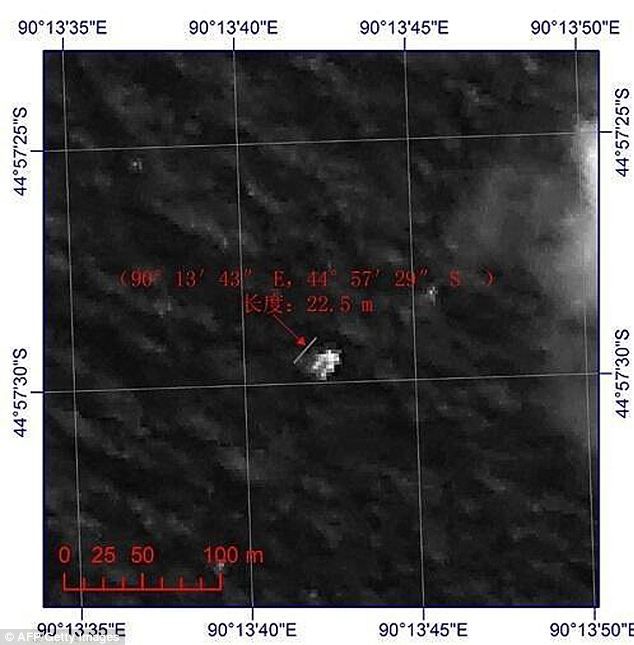
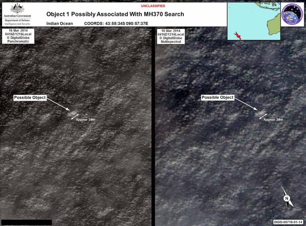
Between 16-23 March satellites of three nations (China, France, Thailand) spotted a debris field of 300 large pieces of floating debris all exceeding 2m in size.
The largest was 22m x 13m across. Many were >5-6m across. Chinese satellite images even found that some had the same red and blue colors of MAS airline livery. on 24 march a Chinese search aircraft photographed some of those items.
On 28 March the JACC published a report which effectively said new fuel consumption analysis of the early portion of the flight (ie alleged flight through Straits of Malacca) showed that MH370 could not have flown to the debris area via the Straits of Malacca, therefore the search was moved north away from the debris (where searching by the Ocean Shield found nothing after chasing phantom ULB signals).
Instead of fussing about theories why not track back from the debris?
Last edited by tazjet; 2014-11-11 at 06:06 PM.
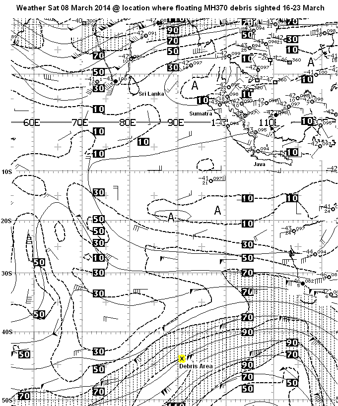
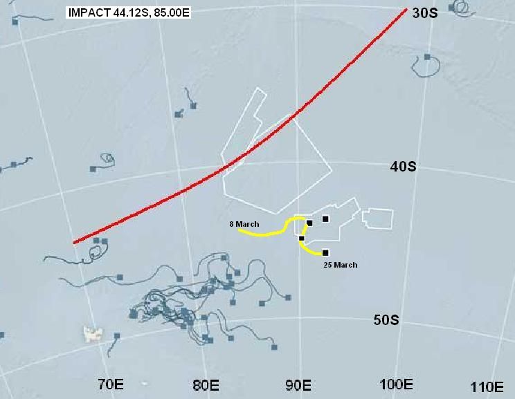
To give some idea, this is a press image of drift buoy drift patterns in the same area which I have annotated with the Southern Arc. the winds do not support a theory that the debris field drifted east from the Southern Arc. The winds were from SWW and gradually backed to SSW as winds dropped.
What this implies assuming this debris field was MH370, is that the Southern Arc (BTO) ping ring has been wrongly calculated. That would arise because the signal delay is highly variable and they wrongly estimated the signal delay or did not understand all the things happening aboard MH370.
For example the ACARS system has an Automatic Frequency Controller (AFC). The AFC uses a temperature sensitive frequency oscillator to adjust frequency to match Doppler shift of the INMARSAT satellite. Without this function MH370 could not track and lock on to the position of INMARSAT. This implies the Navigation system remained functional.
Prior to take off whilst stationary MH370 was showing a signal Doppler shift equivalent to 80-90kt. This tends to suggest that the AFC oscillator was experiencing overheating before take off. If that were the case not only would it distort the signal delay, but could also explain the loss of ACARS and Transponder through electrical failure.
The reverse is also true that if MH370 suffered catastrophic decompression, but kept flying on autopilot, then temperatures would have reduced inside the cabin to about -53 deg C. If that severe chilling of the AFC oscillator also affected the signal delay then it would invalidate any averaging, or calibration of the signal delay prior to 17:07 UTC.
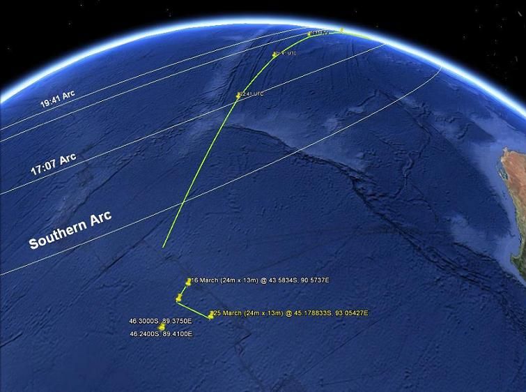
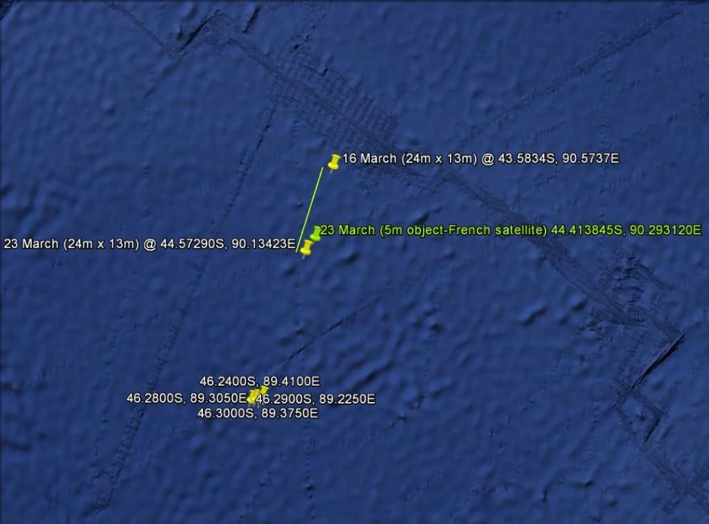
By using two images of large debris piece (24m x 13m), possibly a floating wing between 16-23 March I get a drift of 63nm at 0.3281kt on 197 deg True
compared with Chinese satellite image on 23 March:
Last edited by tazjet; 2014-11-12 at 05:04 PM.
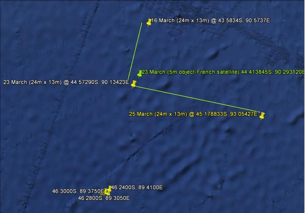
My friend Sally Slater Watson just updated me with a TOMNOD image of the same 24m x 13m floating debris for 25 March which shows an astonishingly fast drift east in just 2 days:
Why isn't JACC doing this kind of work calculating the drift pattern backwards. If an amateur with almost no resources can do this then what are they wasting $120m on?
Last edited by tazjet; 2014-11-12 at 09:16 PM.
The yellow tail tracks an object the size of a Boeing 777 wing back to a likely impact point for 8th March
 Posting Permissions

 Reply With Quote
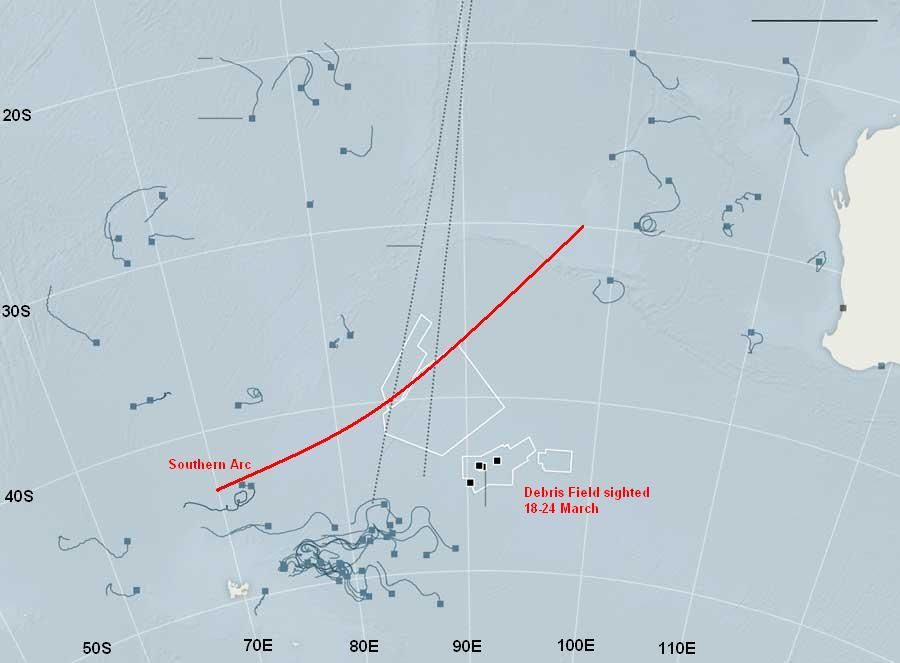
Bookmarks