Without weather, most people wouldn’t be able to start a conversation. “Wow, it’s cold this morning…” or “Did you hear that thunder last night?” or “I hear the weekend is going to be a total mess” are just a few of the countless ways people incorporate weather into their everyday discussions. Usually, the weather-speak doesn’t get too involved but sometimes you’ll hear a more complicated meteorological term tossed around, likely by someone trying to show off. In an effort to help you put one of these folks in his place (or to enable you to be one of these folks), I’ve debunked five often-misunderstood weather terms below.
Microbursts – Responsible for numerous fatal aviation accidents, microbursts are extremely powerful downdrafts found near or within thunderstorms. As this downdraft reaches the surface, it spreads out in all directions, producing temporary surface winds that can sometimes exceed 170mph! Upon encountering such a phenomenon, an aircraft will immediately notice an increase in airspeed and the pilot may attempt to decrease thrust to compensate for this perceived increase in speed. However, once the aircraft passes through the microburst, winds will quickly reverse direction, reducing lift and, due to the pilot reducing thrust, can lead the plane to stall out and crash to the ground. Back in 1975, the crash of Eastern Air Lines Flight 66 near JFK Airport (which left 113 people dead) was attributed to a Microburst and led to the development of the original Low Level Windshear Alert System (LLWAS) by the FAA. Aircraft are not the only objects subject to major damage by microbursts, with numerous cases of major structural damage (similar to that of a tornado) being reported across the US.
Hail – When asked the question “when is hail most likely to happen?”, most respond “in the winter.” “Hail is ice… Ice is cold… Cold is in winter!” However, this could not be further from the truth. For hail to develop, intense thunderstorms are necessary and those are most often found in the Spring and Summer. Hail begins as a drop of water in a giant cumulonimbus (Anvil) cloud. As the drop begins to fall, it encounters intense updrafts that actually lift it higher and higher into the top of the cloud, where the temperature is actually below freezing. Here, the drop freezes and begins to fall again and actually melts a bit on the way down. Depending on how strong the storm is, (or how powerful the updrafts within the cloud are) this process will happen again and again, with the drop rising and falling repeatedly and growing a bit in size every time a cycle is completed. Only once the size and weight of the hail stone exceeds the power of the updraft will it actually fall to earth. Hail can range in size from smaller than a pea to larger than a grapefruit! However, perhaps the most interesting thing about this frozen phenomenon is what happens when you cut it open. Like a tree, hail has rings inside, revealing just how many times the stone cycled through the cloud before falling to earth!
Virga – Though most people have seen virga, I doubt most ever knew what exactly they were looking at. Like smoke descending out of the clouds, virga is falling rain or snow that evaporates (or sublimates) before reaching the ground. Usually just a beautiful display (especially at sunset), this phenomenon can prove very dangerous for aircraft. As the rain or snow vaporizes, the temperature of the surrounding air cools off, making it heavier. If enough air cools off, it can start to descend rapidly, leading to a sort of dry microburst; not dissimilar to the ones discussed above. Therefore, pilots steer clear of these natural wonders, while we on the ground reach for our phones to snap a picture of the “smoking cloud.”
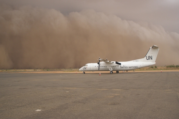
Haboob – Named after the Arabic word for “blowing”, a haboob is a type of dust storm usually caused by rapidly sinking air. Whether it be a downburst in a thunderstorm or a frontal passage, fast-falling cold (or saturated) air in dry regions of the world will often kick up loose sand and dust on the ground. The blowing sediment in the air creates a type of wall cloud that can grow to over 50 miles wide and thousands of feet high! If the haboob is generated due to a thunderstorm, the dust will often precede the storms arrival, moving at up to 60mph! Visibility can drop in an instant, shutting down airports for brief periods and posing serious risks to aircraft in the vicinity. When rain follows the dust storm, it is often laden with dust and thus, in extreme cases, mud storms have been reported.
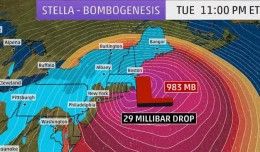
Derecho – We don’t hear about this phenomenon very often, but when we do it usually means a lot of damage has been (or is about to be) done. A derecho, named after the Spanish word for “straight,” is a very severe line of thunderstorms (squall line) that maintains straight-line wind gusts of over 58mph (often much stronger) over a swath of at least 250 miles. In addition, this line of storms must sustain itself for at least six hours! Derechos are well-known for their signature shape, a “bow echo,” named after an archer’s bow and often looking like a backwards “C.” Though we see numerous squall lines throughout the year, they seldom develop all of the aforementioned features and often die out within a couple of hours. Since derechos require a large amount of moisture, atmospheric instability, and vertical wind shear, they are most often observed in the summer months across North America, when these necessary ingredients are in large supply. It should be noted, however, that they can happen at anytime of year and have been observed in many countries around the world. While tornadoes can yield catastrophic damage along a normally narrow path, derechos can bring that kind of devastation to a wider area and when you hear about one approaching your area, you’d be wise to take shelter!
Adam Daum is a Senior Aviation Meteorologist with WSI and is embedded within the System Operations Center of a major NY-based airline. Hailing from Oceanside, NY, Adam graduated from Cornell University in 2005 and spent the next 5 years working at NBC News’ “The Today Show” and NY1 News as a weather producer. His love for Aviation (and Israel) led him to join the Israeli Air Force in 2010 and work as an Aviation Forecaster for the Israel Meteorological Service from 2011-2013.